

After recovering from record-setting flooding, many in King County are wondering why December’s flooding has been more extreme and if climate change is to blame.
The primary cause of the flooding was a series of “significant” atmospheric rivers with heavy precipitation, said Clinton Alden, University of Washington Mountain Hydrology Research Group graduate student. Alden and fellow graduate student Danny Hogan also run a website called Cascade Mountain Weather to provide accurate, up-to-date weather and snow forecasts for Washington’s ski areas for backcountry enthusiasts.
Atmospheric rivers are long, narrow “rivers” of moisture in the atmosphere that generally originate in the subtropical latitudes and bring precipitation and warmer air to Washington. Common in November and December, this storm was ranked as a 4 out of 5 on the atmospheric river scale from the Center for Western Weather and Water Extremes at UC San Diego, which measures wind speeds and the amount of water vapor in the atmosphere.
“Many mountain locations in the Olympics and Cascades received 15 inches or more of precipitation (almost all rain) in the 72-hour period” from Dec. 8 to Dec. 11, Alden said.
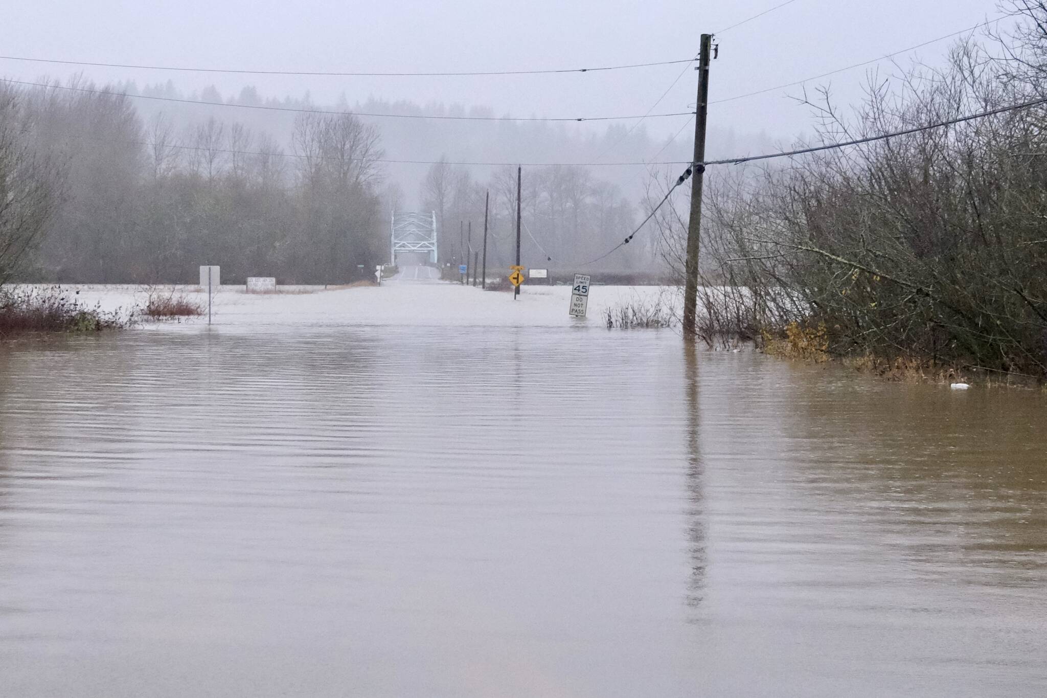
NE 124th Street, one of the two roads that takes Duvall residents across the river and quickly out of the Snoqualmie Valley, was closed due to flood water, Dec. 10, 2025. Photo by Grace Gorenflo/Sound Publishing
While most of the mountain sites do not have records of more than 50 years ago, the precipitation in that time period broke into the top 10 highest 3-day totals at both Paradise Ranger Station at Mount Rainier National Park and at Stampede Pass near Snoqualmie Pass, which have 108 and 80 years of records, respectively.
While Alden said they cannot say for certain that individual storms are caused by climate change, the Cascades are on the cusp of the snow vs. rain elevation line, making the region very sensitive to slight increases in air temperature. He said the impact of global warming may be lower elevations receiving less precipitation as snowfall.
“As a very rough rule of thumb, for every three degrees [Fahrenheit] temperature increase, the rain vs. snow line rises by 1,000 feet of elevation,” Alden said.
During this significant atmospheric river, the elevation for most heavy precipitation to be snow was above 9,000 feet. Because most of the Washington Cascades are below this elevation, nearly all the precipitation from the storm fell as rain, which does not stay in place like snow does.
To add to the already high levels of liquid precipitation, Alden said, the soil moisture conditions in the Cascades were above normal because of the rain over the previous weekend.
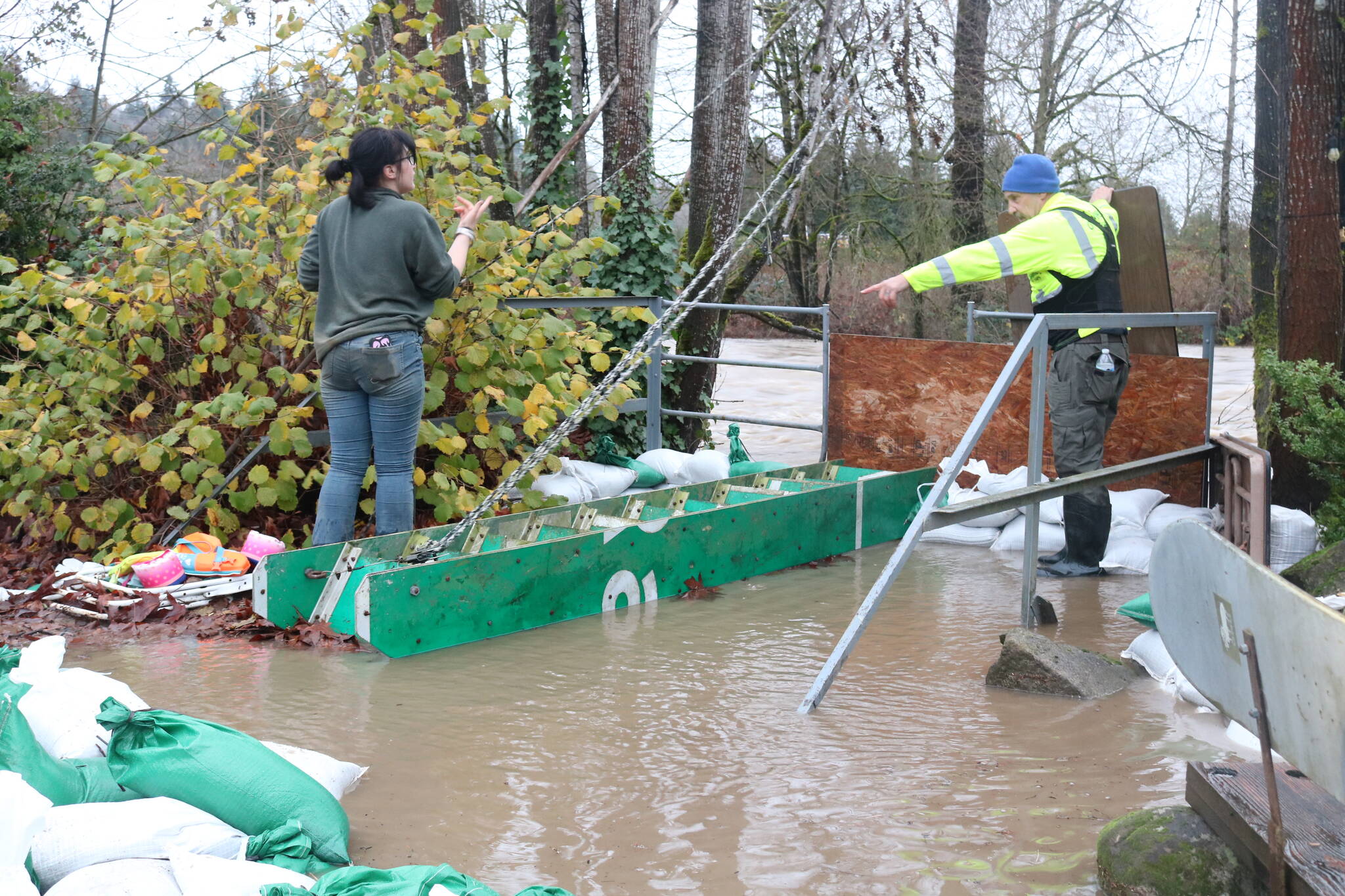
Ruby Randolph, 16, helps her dad Steve Randolph, a board member for Sustainable Renton, build up another wall of sandbags late Dec. 11 as water from the Cedar River seeps into the backyard of a Maplewood resident. Photo by Bailey Jo Josie/Sound Publishing
Local rivers
Wet soil not being able to absorb more water is a primary driving force in flooding, according to a study published by the Journal of Hydrometeorology in June 2025. After examining 122 different watersheds on the U.S. West Coast, researchers found that maximum streamflows are commonly 2 times to 4.5 times larger during wet soil conditions than dry soil conditions.
“The combination of sustained heavy precipitation, saturated soils, and high freezing levels significantly contributed to the flooding,” said Danny Hogan of Cascade Mountain Weather. “However, snowmelt likely played a negligible role because of the meager snowpack in the mountains. Essentially, there simply was not enough snow available to make much of a difference.”
These factors led to many rivers in King County reaching record or near-record heights. Water levels reaching 18.22 feet on the Cedar River at Renton broke its previous record by more than a foot at 3 p.m. Dec. 11. The Duwamish River at Tukwila reached 21.87 feet on Dec. 15, and the Green River at Auburn reached 68.7 feet on Dec. 13, but both did not set records.
The Snoqualmie Valley, which includes the Snoqualmie River, saw its worst flooding since 2019, setting records particularly in the Duvall area. This year, king tides aligned with the atmospheric river weather system, and Duvall had an abundance of water coming from several directions.
Further north, the Snohomish River at Snohomish, Skagit River at Mount Vernon and the Nooksack River at North Cedarville all set record heights as well.